OpenUAS
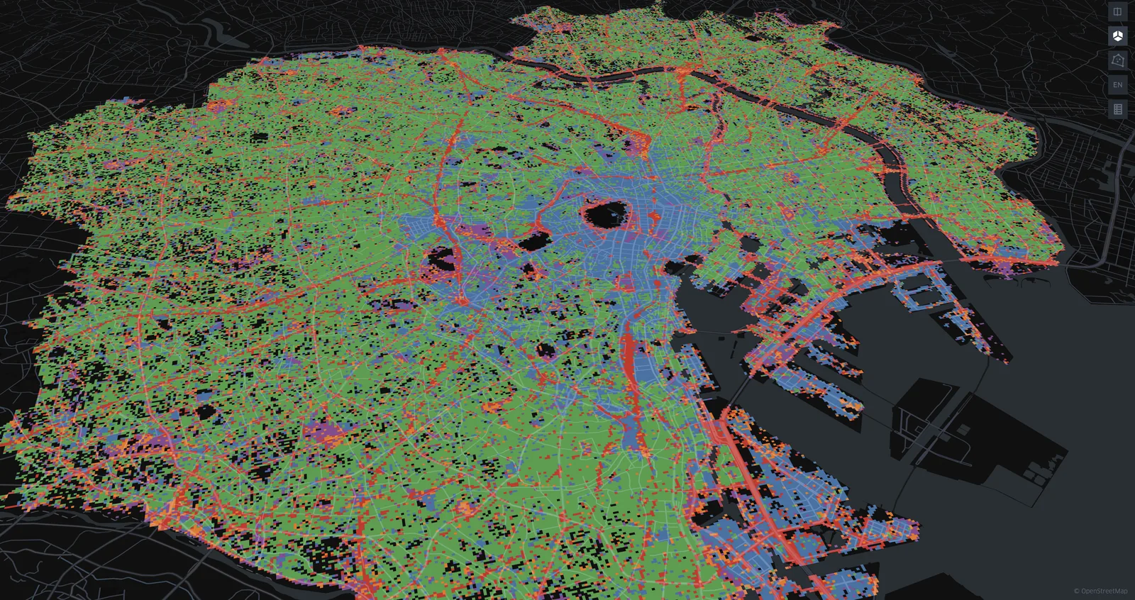
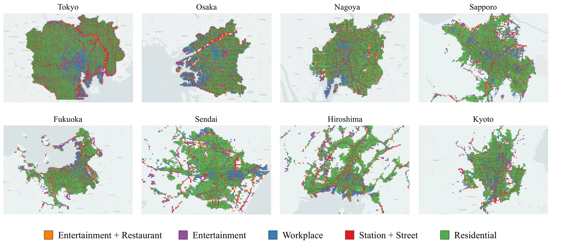
OpenUAS is an open dataset that represents urban area usage patterns as vectors, based on large-scale human mobility data from eight major cities in Japan. For each area in a city, it captures characteristics such as office, residential, and commercial districts from patterns of when and how long people stay.
Paper / Dataset / Code / Press Release
Overview
Urban space is often described by administrative boundaries, land use, or facility information, but these alone do not sufficiently capture how people actually use a place.
OpenUAS represents how each area is used as a numerical vector, using stay information extracted from GPS-based mobility data together with Area2Vec. For example, it can analyze areas with long daytime stays on weekdays, areas with concentrated visits on weekends, or areas with many short morning/evening stays — all from human behavior patterns.
OpenUAS also uses an anchoring method so that area embeddings from different cities or different periods can be compared in a shared embedding space. This makes it possible to compare area-usage patterns across cities and over time without sharing raw location data — for example, finding areas similar to a given area in another city, or analyzing temporal changes such as before and after a commercial facility opens.
Dataset
OpenUAS provides the following data:
- Area embeddings for 8 major cities in Japan
- Trained Area2Vec models
- GeoJSON files for map visualization
- Cluster labels for 5, 10, and 20 clusters
- Cluster visualization HTML built with Kepler.gl
- Stay-trend graphs per cluster
- Anchor data
- Sample data and scripts for training Area2Vec
| Dataset name | OpenUAS |
|---|---|
| Cities | Tokyo, Osaka, Nagoya, Sapporo, Fukuoka, Sendai, Hiroshima, Kyoto |
| Scale | 1.3M+ 50 m meshes |
| Coverage | ~3,300 km² |
| Input | Stay records extracted from GPS-based human mobility data |
| Data volume | 175M+ stay records |
| Main outputs | Area embeddings, cluster labels, GeoJSON files, trained models, anchor data |
| Paper DOI | 10.48550/arXiv.2407.19872 |
Use Cases
OpenUAS is intended for uses such as:
- Functional analysis of areas within a city
- Cross-city similar-area search
- Time-series analysis of urban change
- Characterizing commercial, residential, and office areas
- Applications to urban planning, store-location strategy, and transportation analysis
- Comparing your own location data with open data
Demo / Web App
Coming soon.
Paper
Naoki Tamura, Kazuyuki Shoji, Shin Katayama, Kenta Urano, Takuro Yonezawa, and Nobuo Kawaguchi.
OpenUAS: Embeddings of Cities in Japan with Anchor Data for Cross-city Analysis of Area Usage Patterns.
arXiv:2407.19872, 2024.
DOI: 10.48550/arXiv.2407.19872
@misc{tamura2024openuas,
  title={OpenUAS: Embeddings of Cities in Japan with Anchor Data for Cross-city Analysis of Area Usage Patterns},
  author={Tamura, Naoki and Shoji, Kazuyuki and Katayama, Shin and Urano, Kenta and Yonezawa, Takuro and Kawaguchi, Nobuo},
  year={2024},
  eprint={2407.19872},
  archivePrefix={arXiv},
  primaryClass={cs.LG},
  doi={10.48550/arXiv.2407.19872}
}